Project Home
 Contact Us
 Resources


I-10 Study: Loop 202 to State Route 387
This Page will be updated as the Wild Horse Pass Project moves forward
Content below reflects previous study information. Check back soon for updates.
Overview
Developing an I-10 vision and strategy to meet future needs.
In the summer of 2019, the Arizona Department of Transportation (ADOT) and partner agencies took the essential first step toward studying ways to increase the capacity of a 26‑mile section of Interstate 10 (I-10) south of the Phoenix metropolitan area.
In collaboration with the Gila River Indian Community, the Bureau of Indian Affairs (BIA), the Federal Highway Administration (FHWA) and Maricopa Association of Governments (MAG), ADOT has prepared an environmental study under the National Environmental Policy Act (NEPA) and engineering study to evaluate improvements to I-10. This study is important because I-10 supports significant commercial and economic growth for the region, state and nation, and is considered a Key Commerce Corridor.
The study process is producing a NEPA-compliant environmental report (an Environmental Assessment [EA]) and an engineering report called a Design Concept Report (DCR) that:

Developed a range of alternatives and options, including the no-build alternative.
Evaluated the alternatives’ and options’ costs, right-of-way implications, engineering factors and environmental considerations.
Documents the mitigations necessary to offset identified impacts associated with the preferred alternative.
Will select a preferred alternative based on technical analysis and agency and public feedback received.


Study Area
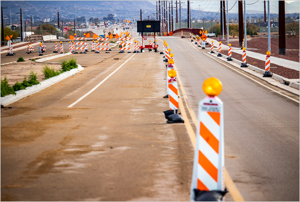
This study is focused on the 26-mile section of I-10 between the Loop 202 interchange south of Phoenix to just south of the State Route (SR) 387 interchange near Casa Grande. This section of I-10 has been labeled as the Wild Horse Pass Corridor. It is the last remaining segment of I-10 between Phoenix and Tucson that has only two lanes in each direction.
The I-10 bridges over the Gila River are part of a separate ADOT project that is excluded from this study but closely coordinated with the Community. For more information on the I-10 Bridge Project, please click here.
Why Here, Why Now?
Over the last decade, ADOT has been expanding the capacity of I-10 between Phoenix and Tucson in segments. As mentioned above, I-10 consists of three lanes in each direction between SR 387 near Casa Grande and Tucson. That leaves the 26 miles of I-10 across the Gila River Indian Community as the only remaining stretch with two lanes in each direction.
This segment of I-10 is critical for Arizona’s economy, as it links the state’s largest metropolitan areas of Phoenix and Tucson while also providing a key link for the national and international movement of freight. Arizonans use this route to commute to and from Phoenix daily from rural communities. Locally, the route also serves the Gila River Indian Community by providing key connections to employment, medical, educational and other necessary services both within and outside of the Community.
Improvement Considerations
In addition to the no-build alternative, two build alternatives are being considered for I-10 through this 26‑mile segment. Both would widen I-10 from two lanes to three lanes in each direction, the difference being whether this widening is accomplished in the median of I-10, or to the outside of I-10. If one of these build alternatives is selected and built, I-10 would then provide three continuous lanes in each direction between Phoenix and Tucson.
This study is also evaluating extending the High Occupancy Vehicle (HOV) lanes on I-10 from Loop 202 south to the Riggs Road interchange with median widening. In addition, the study is evaluating improvement options for the existing interchanges and roads that cross over I-10 in this corridor. Finally, the study is evaluating an option that would add a broadband fiber optic facility into the I-10 corridor.
Proposed improvements include:
- Adding a new general purpose lane in the median in both the east- and westbound directions for the entire 26-mile corridor.
- Extending the High Occupancy Vehicle (HOV) lane in each direction on I-10 from Loop 202 to Riggs Road.
- Improving interchanges and crossroads for enhanced capacity and safety, and multimodal (bike and pedestrian) crossings, as well as addressing age/condition issues.
- Removal of Dirk Lay Road crossing over I-10 and the return of the associated easement/right-of-way.
- Replacing the aging and narrow Gila River Bridges as a part of a separate study.
- Installing freeway management technology to allow for the installation of sensors, cameras, variable message signs and other highway safety-related technology.

Events
In collaboration with the Gila River Indian Community, the Bureau of Indian Affairs, the Federal Highway Administration (FHWA) and the Maricopa Association of Governments, the Arizona Department of Transportation (ADOT), has prepared a draft Environmental Assessment (EA) and draft Design Concept Report (DCR) for the Interstate 10 (I-10) Study: Loop 202 to State Route 387 (SR 387).
View the draft EA and DCRThree in-person and one virtual public hearing will be held to provide an overview of the draft EA and DCR, share ADOT’s preliminary recommendation and accept public comment. The same information will be presented at each meeting.
Public Hearings Agenda Schedule
IN-PERSON PUBLIC HEARING AGENDA*
- 5:30 – 6 p.m. — Open House
- 6 – 6:30 p.m. — Formal Presentation
- 6:30 – 7:30 p.m. — Formal Public Comments/Open House
*At the Sept. 15 hearing at District 4, the presentation will be continuously repeated and the open house and formal comment period will be available throughout the hearing.
Virtual Public Hearing Agenda**
- 5:30 p.m. — Formal Presentation
- 6 – 6:15 p.m. — Q&A
- 6:15 – 7:15 p.m. — Formal Public Comments
- 7:30 – 8 p.m. — Formal Presentation
- 8 – 8:15 p.m. — Q&A
- 8:15 – 9 p.m. — Formal Public Comments
**As a part of the virtual public hearing, we are allowing two opportunities to hear the presentation, provide formal comment and ask questions.
PUBLIC HEARINGS
In-Person Public Hearing #1
Wednesday, Sept. 7, 2022 | 5:30 – 7:30 p.m.
Valley Christian High School, 6900 W Galveston St., Chandler, AZ 85226
In-Person Public Hearing #2
Tuesday, Sept. 13, 2022 | 5:30 – 7:30 p.m.
Vista Grande High School, 1556 N Arizola Rd., Casa Grande, AZ 85122
In-Person Public Hearing #3
Thursday, Sept. 15, 2022 | 5:30 – 7:30 p.m.
District 4 Multipurpose Building, 2230 N Home Run Dr., Sacaton, AZ 85147
This venue will comply with current COVID-19 Executive Orders for public facilities and requires masks. Masks will be available.
Virtual Public Hearing (Call-in/Online through Webex)
Tuesday, Sept. 20, 2022 | 5:30 – 9 p.m.
English
Join online Phone: +1-408-418-9388
Meeting number (access code): 2484 471 6549
Password: WHP2022 (9472022 from phones)
Spanish
Únete en línea Teléfono: +1-408-418-9388
Número de Reunión (Código de acceso): 2490 170 8079
Clave: WHP2022 (9472022 from phones)
HOW TO PARTICIPATE IN THE PUBLIC MEETING
The live virtual public meeting will be held November 18, 2020 from 5:30 to 7 p.m. and will be conducted by phone and online. There are three ways to participate in the live event:
- REGISTER TO RECEIVE A CALL: https://vekeo.com/event/azdot-61595/
- ONLINE: Visit the study website at i10wildhorsepasscorridor.com and click on the meeting link to listen in, watch the presentation and participate. Please log in a few minutes prior to the 5:30 p.m. meeting time.
- CALL IN: Call 833.380.0669 at the time of the event to listen to the meeting. Please note you will not be able to view the presentation with the call in option.
Attendees will be able to submit verbal comments by phone or online via the website during the meeting. Instructions for how to submit questions will be provided during the presentation.
Timeline
In collaboration with the Gila River Indian Community, BIA, FHWA and MAG, ADOT has prepared an environmental study for I-10 from Loop 202 to SR 387 under NEPA and an engineering study to evaluate improvements to I-10.
Following our public hearings and comment period, the study team will review and evaluate all input from the Gila River Indian Community, partner agencies and the public, and select a final alternative. This selection, combined with the input from the public hearing and associated public comment period, will be documented in the Final EA and DCR documents which will be published on this website once complete.
Funding
Improving I-10 across the Gila River Indian Community is a project of regional significance for Arizona. ADOT, MAG, BIA, FHWA and the Gila River Indian Community continue to partner to deliver this important project, including efforts to secure the necessary funding. The improvements for this 26-mile corridor are about $990 million (including the Gila River Bridge replacement project).
To date, about $640 million has been allocated to the corridor by the State and MAG, which includes the recently approved $400 million as part of the State Budget for fiscal year 2023. Leveraging this state and local funding, ADOT applied for a federal MEGA grant to close the gap of approximately $360 million. If successful, the combination of state, local and federal funds will allow project construction to begin as quickly as possible without budgetary constraint delays
Note: All values above expressed in Fiscal Year 2024 dollars
Funding Sources

Implementation
The study would conclude with a selected alternative and an associated cost estimate to design and construct it, should a build alternative be selected. The study will also determine how construction should be implemented over time, and in segments, if funding is allocated over several years.
In coordination with the Gila River Indian Community, ADOT is committed to identifying and pursuing all possible funding options for improving this section of I-10, including federal funding options. It is important to note that the completion of this engineering and environmental study is required for any improvements to be eligible for federal funding.

Project Materials Are Available
Review resources online
Public Meeting MaterialsReportsMaps
Contact the Study Team
Please use the contact form or the methods listed below to send questions, comments, and feedback to the project team.

 Call the bilingual study line: 602-522-7777
 Email: i10wildhorsepasscorridor@hdrinc.com
 USPS Mail:
I-10 Wild Horse Pass Corridor Study Team c/o HDR, Inc.
20 E. Thomas Road, Suite 2500
Phoenix, AZ 85012
Your message has been sent!